
Groundwater Recharge Monitoring Using Piezometers
By Allegiance Water Management, Vadodara
You have built
the recharge wells, fitted the filters and connected the roof pipes. The
monsoon comes and goes. Then someone in a management meeting asks the obvious
question: "Is it actually working?"
Without data,
the honest answer is "we think so". With a well-planned piezometer
setup, the answer is a graph, a number and a clear story. This guide explains
how groundwater recharge monitoring works, how to set it up, and how to turn
readings into real proof of results.
Why Groundwater Recharge Monitoring Matters
•
Proves the investment: Shows management that
rainwater harvesting delivered real results, not just pipes and pits.
•
Supports compliance: CGWA NOCs commonly require
piezometer data, and recharge results strengthen your record at renewal.
•
Spots problems early: If levels stop responding,
the recharge structure may be clogged and need cleaning.
•
Guides expansion: Data shows where extra
recharge points will help most.
•
Strengthens ESG reporting: Measured water put
back into the ground is far more credible than estimates.
How to Measure Groundwater Recharge: The
Basic Idea
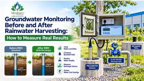
When water
enters an aquifer, the groundwater level rises. A piezometer, which is a
dedicated observation well fitted with a digital water level recorder (DWLR),
records that level continuously. By comparing levels before, during and after
the monsoon, and comparing wells near and far from your recharge structures,
you can see how much difference recharge is making.
Setting Up a Recharge Monitoring Network
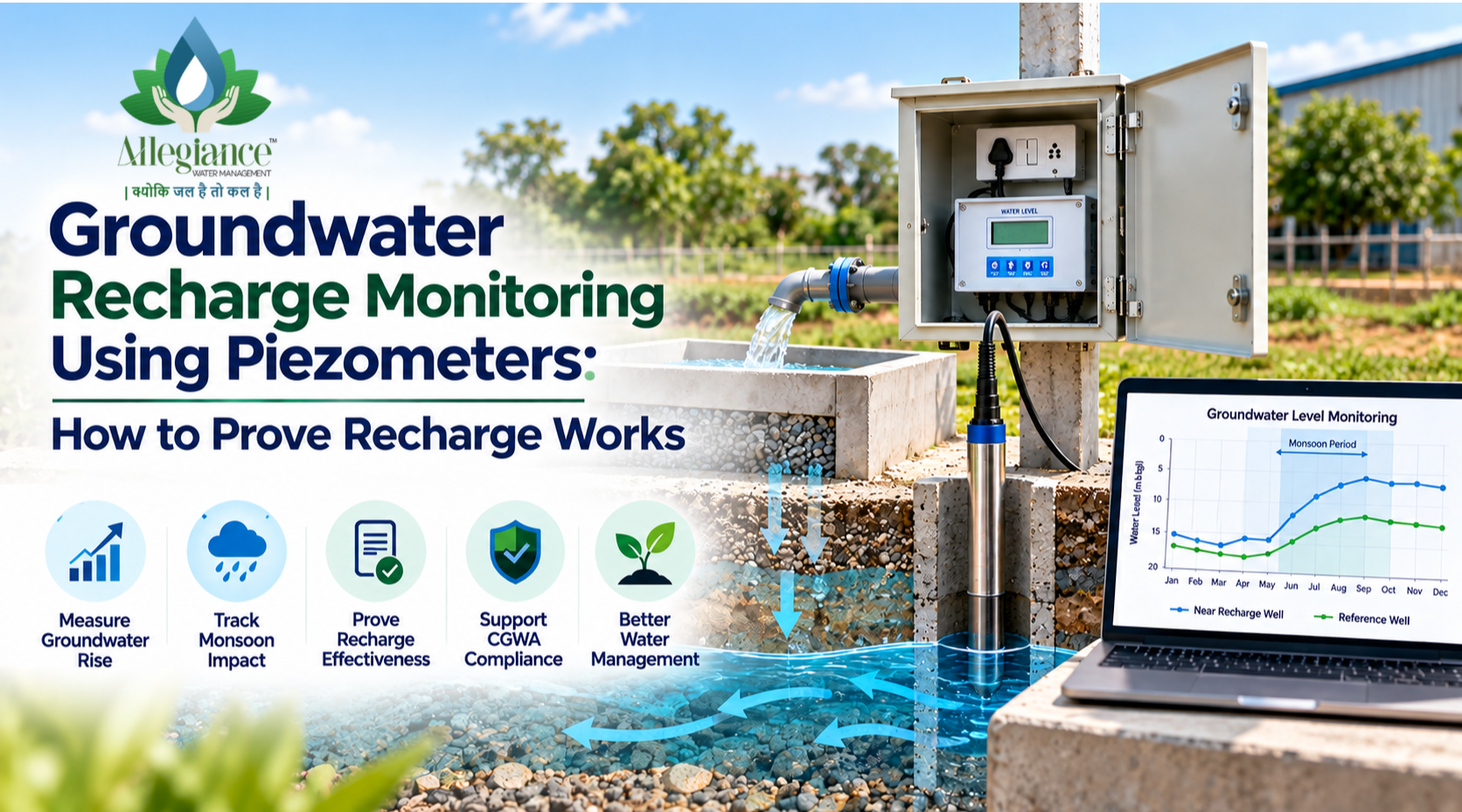
1. A Piezometer Near the Recharge Well
Place a
piezometer near the recharge well or recharge zone, close enough to catch the
effect but not inside the structure itself. This well shows how local
groundwater responds when recharge water enters the ground.
2. A Reference Piezometer Further Away
Groundwater
also rises naturally during the monsoon. A second piezometer away from the
recharge zone acts as a reference. The difference between the two wells helps
separate the effect of your recharge from normal seasonal rise.
3. A Flow Meter on the Recharge Inlet
Where
practical, a flow meter on the pipeline feeding the recharge structure records
exactly how much water went in. Combined with level data, this gives a much
clearer picture.
4. A Rainfall Record
Local rainfall
data, from your own rain gauge or a nearby weather station, helps you match
each rise in groundwater level to a rain event.
Pre-Monsoon and Post-Monsoon Water Level:
The Key Comparison
The simplest
and most widely used comparison is between the lowest level before the monsoon,
usually in May or early June, and the highest level after it, usually in
October or November. A clear rise near the recharge zone, larger than at the
reference well, is a strong sign that recharge is working. Tracking this
comparison year after year shows whether groundwater under your site is
recovering, steady or still falling.
Water Level Fluctuation Method: A Simple
Estimate
Hydrogeologists
often estimate recharge using the water level fluctuation method:
Recharge (m³) = Rise in water level (m) x Specific yield x
Area (m²)
Specific yield
is the share of the rock or soil volume that releases or stores water. It
depends heavily on geology, from low values in hard rock to higher values in
sandy alluvium, so it should be taken from a geohydrological study of your
area.
For example, if
groundwater rises by 1.5 m over an area of one hectare (10,000 m²) and the
specific yield is 0.10, the estimate is about 1,500 m³, or roughly 15 lakh
litres. Treat this as an estimate rather than an exact figure, and compare it
with the volume recorded by your inlet flow meter.
Recharge Monitoring Data Analysis: What to
Look For
|
What You See |
What It Usually Means |
|
Quick rise after heavy rain near the recharge well |
Recharge structure is accepting water well |
|
Bigger
seasonal rise near recharge than at reference well |
Recharge
is adding to natural recovery |
|
Little or no response even after heavy rain |
Possible clogging, blocked filter or silted structure |
|
Post-monsoon
levels improving year after year |
Long-term
groundwater recovery under your site |
|
Sharp daily drops and recoveries |
Piezometer is too close to a pumping borewell |
Groundwater
responds slowly and is affected by many things, including rainfall,
neighbouring borewells and geology. Look at trends over several seasons rather
than drawing conclusions from one year.
Common Mistakes in Recharge Impact
Assessment
•
Using a pumping borewell instead of a dedicated
piezometer, which mixes pumping effects into the data
•
Having no reference well, so natural seasonal rise is
mistaken for recharge
•
Taking only one or two manual readings a year instead
of continuous data
•
Not maintaining filters and silt traps, so the recharge
structure slowly clogs
•
Judging results after a single dry or unusually wet
monsoon
Turning Data into a Recharge Report
A simple annual
recharge report can include a site map with recharge points and piezometers,
pre-monsoon and post-monsoon levels, a graph of water levels against rainfall,
the inlet flow meter total and an estimated recharge volume. This gives
management, auditors and CGWA a clear, data-backed picture of your rainwater
harvesting effectiveness.
Groundwater Recharge Monitoring in Gujarat
with Allegiance
Allegiance
Water Management has been designing recharge systems and monitoring groundwater
since 2012, with more than 1,000 projects completed for clients including
L&T, NTPC, Polycab and Torrent Power. We can help with:
•
Geohydrological surveys and rainwater harvesting
feasibility studies
•
Recharge wells, V-wire injection wells, defunct
borewell recharge and recharge ponds
•
Digital water level recorders with GSM telemetry and
manual water level indicators
•
Flow meters for recharge inlets and abstraction
borewells
•
CGWA NOC and compliance support
We serve
Vadodara, Ahmedabad, Bharuch, Halol, Surat, Valsad and Vapi, along with Daman,
Diu, Dadra and Nagar Haveli and Indore.
Show What Your Recharge System Is Really
Doing
Already have recharge structures but no proof of results? Share your
site details with us, and we'll suggest a simple monitoring setup that turns
your groundwater data into clear evidence.
Allegiance
Water Management
A unit of Allegiance Enterprises
Phone: +91 9574198769
Email: info.allegianceindia@gmail.com
Website: www.allegianceindia.in
Address: 28 & 29, Aura Square, 3rd Floor, Panchvati
Circle, Gorwa Refinery Road, Panchvati, Vadodara, Gujarat 390016